Managing Aerial Data as Your Team Grows: Key Points to Check
When a small drone operation starts taking on more projects and more people, the way aerial data is handled can quickly become a bottleneck. Early on, a single pilot might upload files, process them on a laptop, and share results via email. But as the team expands, that informal workflow begins to fray. Images get stored in different places, processing times slow down, and it becomes harder to keep track of which version of a dataset is the final one. A shift toward a structured approach to data management becomes necessary, and an aerial imagery platform can provide the backbone for that shift.
Why data management matters more with a bigger team
With a handful of people, everyone knows where things are. With ten or twenty people across multiple projects, that knowledge scatters. Files end up on personal drives, naming conventions diverge, and the time spent searching for a single orthomosaic starts to add up. The real cost is not just storage but lost productivity and the risk of delivering outdated or incomplete data to a client. A deliberate system for organizing, processing, and sharing aerial data keeps the team moving fast without sacrificing accuracy.
Checklist points for growing teams
The following points cover the main areas where a maturing drone operation should evaluate its data practices. They are not exhaustive but address the common pain points that emerge as headcount and project volume increase.
1. Centralize file storage and access
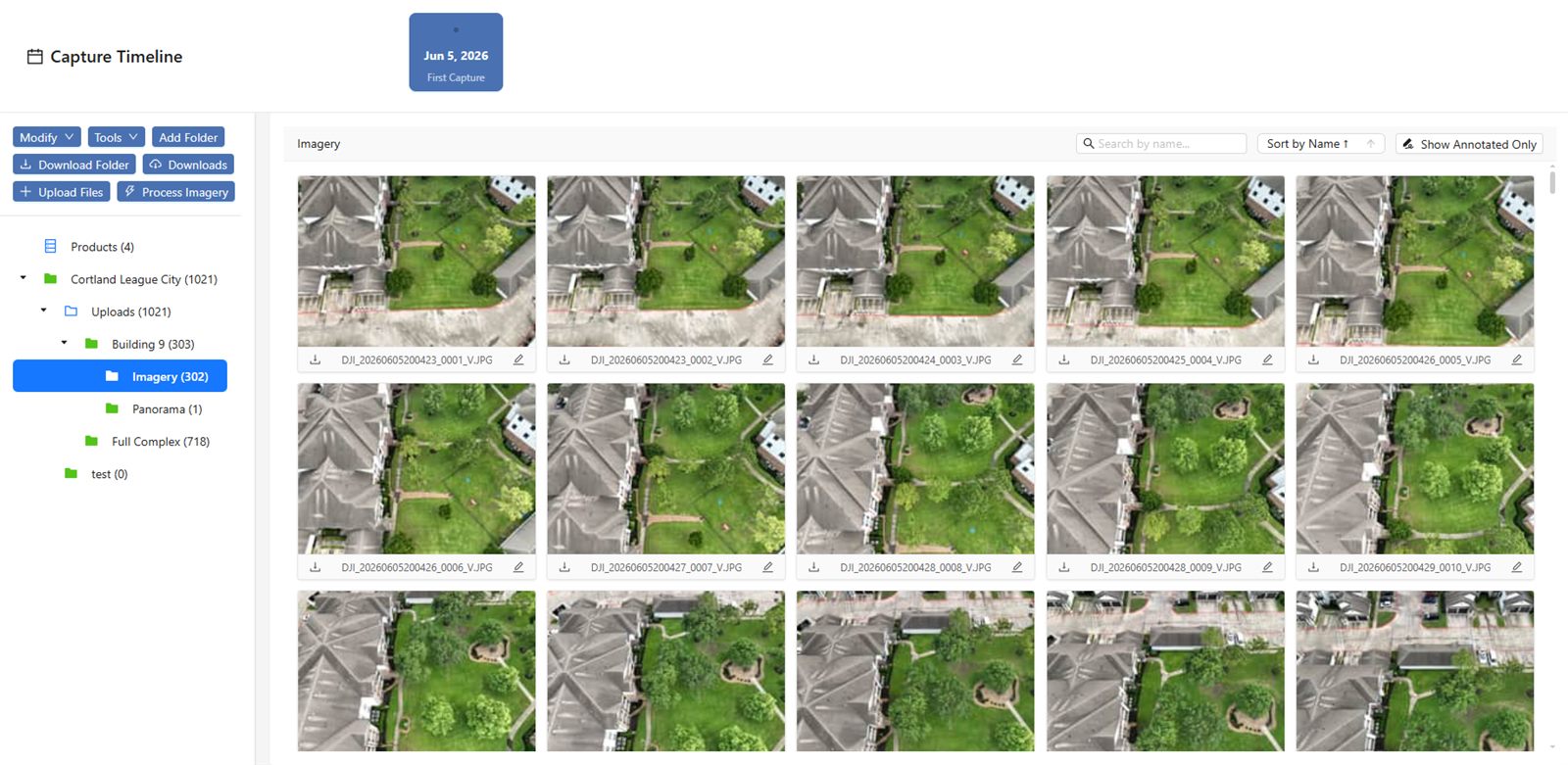
If each team member keeps raw images and processed outputs on their own machine, you will eventually have conflicts. One person may work on an older version of a dataset while another has already corrected a misalignment. A single source of truth, hosted on an aerial imagery platform or a cloud storage system with proper permissions, solves this. Everyone pulls from and pushes to the same repository. The platform should support the file formats your team uses, from raw TIFFs to GeoTIFFs, and allow for easy uploads from multiple locations.
2. Standardize naming and metadata conventions
When a project involves ten flights over two weeks, the files need to tell a story. A filename like "flight_20240315_west_field_survey" is far more useful than "DJI_0001.tif". Agree on a naming convention that includes date, location, and purpose. Metadata is equally important. Ensure that each upload carries essential information such as altitude, camera model, and GPS coordinates. An aerial imagery platform that ingests and displays this metadata saves hours of manual sorting later.
3. Automate processing pipelines
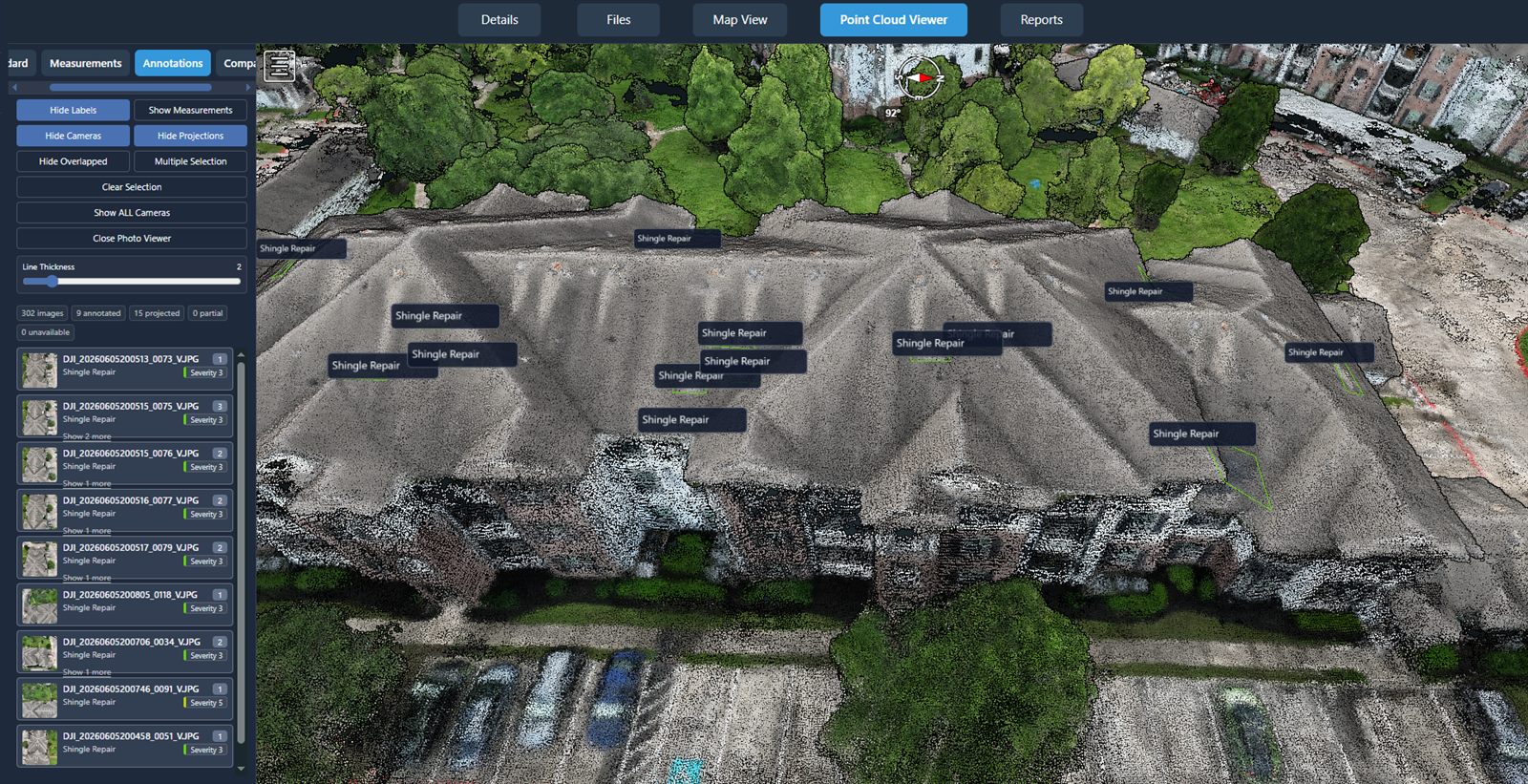
Manual processing of every image set is slow and error-prone. As the volume grows, relying on one person to run photogrammetry software on a local machine becomes unsustainable. Look for an aerial imagery platform that offers automated processing: upload raw images, and let the system stitch orthomosaics, generate point clouds, or produce digital elevation models. Automation also reduces the chance of human error, such as misaligned images or incorrect coordinate references.
4. Build a review and approval workflow
Not every processed dataset is ready for the client. There should be a step where a senior team member reviews the quality of the orthomosaic, checks for gaps or artifacts, and confirms the data meets project specifications. An aerial imagery platform that supports versioning and commenting makes this review process transparent. The reviewer can leave notes directly on the visualization, and the original processor can revise without losing the previous version. This workflow prevents the wrong dataset from being shared.
5. Plan for secure external sharing
Clients and partners often need access to the data without having to download massive files. Sharing via email attachments or public links is insecure and impractical for large datasets. A platform that provides password-protected, time-limited links with view-only permissions allows you to share results safely. The client can inspect the orthomosaic, take measurements, or compare layers, all without needing specialized software. This also keeps your raw data under your control.
What to look for in an aerial imagery platform
Choosing the right platform for a growing team involves more than just storage space. The platform should integrate with the tools your team already uses, such as GIS software or drone flight planning apps. It should handle large file sizes without crashing, and its interface should be intuitive enough that new team members can start contributing quickly. Support for common data formats like GeoTIFF, LAS, and orthophotos is a baseline requirement.
Another factor is the ability to visualize and compare datasets side by side. A team that inspects a construction site over time needs to see how the terrain has changed between flights. The platform should allow overlaying images, adjusting transparency, and measuring distances or volumes directly in the browser. This turns the platform from a passive storage system into an active analysis tool.

How a structured approach supports team growth
When the data management process is clear, new hires can get up to speed faster. They do not need to learn a bespoke system that lives in someone's head. Instead, they follow documented steps: upload to the platform, run the automated processing, submit for review, and share with the client. This consistency reduces errors and frees senior team members to focus on more complex tasks, such as interpreting the data or planning the next mission.
One option that aligns with this structured approach is National Drone Services drone data management. It provides a central hub for uploading, processing, organizing, visualizing, comparing, measuring, and sharing drone aerial data. For teams that need a nationwide turnkey capture service, it can also handle the flight acquisition, so the internal team focuses on analysis and delivery. National Drone Services drone data management works as the backbone for teams that want to scale without reinventing their workflow.
Common pitfalls to avoid
Even with a good platform, teams can stumble. One common mistake is not enforcing the naming conventions consistently. If two people use different date formats, the sorting breaks down. Another is neglecting to set access permissions properly, allowing junior team members to accidentally delete or overwrite files. Regular training and a simple written policy can prevent these problems.
Another pitfall is relying too heavily on a single person to manage the platform. If that person leaves or is on leave, the whole operation stalls. Cross-train a few team members on the administration tasks, such as setting up projects, inviting users, and managing storage. This redundancy keeps the workflow running smoothly even during transitions.
When to upgrade your approach
The right time to formalize data management is before the pain becomes acute. If you notice that team members are spending more time looking for files than analyzing them, or if a client has received the wrong version of a dataset, it is already late. Start with the checklist above and implement the changes gradually. Even small improvements, like a shared naming convention or automated processing, can yield immediate time savings.
As the team grows, revisit the checklist every quarter. New project types may require additional data formats or higher resolution. The platform you chose should be able to evolve with those needs. A flexible aerial imagery platform that supports plugins or API access can accommodate custom workflows without requiring a complete migration.
Final practical advice
Growing a drone operation is exciting, but the data that comes with it can quickly become overwhelming. The shift from a one-person show to a team requires thinking about data as a shared resource that needs structure, security, and accessibility. The checklist above gives a starting point for evaluating where your team stands and what to prioritize next. By treating data management as a core part of your operation, rather than an afterthought, you set the stage for sustainable growth.
National Drone Services on social media
 Facebook
Ends · MEASUREDFROMABOVE